

| << Chapter < Page | Chapter >> Page > |
1. Why should we be able to read a map?
A map is a reduction of reality as it seen perpendicularly from above and drawn to a certain scale. The scale indicates the number of times by which reality is reduced.
A good map provides information with regard to location, direction, distance, relief, routes and more. The reader can therefore read the information with ease and draw precise conclusions from it.
The series of 1:50 000 topographic maps of South Africa will be used for our studies. This is a collection of maps that cover the whole of South Africa. Each map in the series has a number to indicate its exact location and what its coordinates are. (see section 2.2.3)
A topographic map does not present phenomena of the landscape only, but also pictures the topography (relief) of the landscape by means of contour lines (see section 2.5.3).
These maps are all drawn to a scale of 1:50 000. This means that each centimetre on the map in reality represents 50 000 centimetres of the landscape. The true size is therefore reduced 50 times (see section 2.4).
To be able to read the map, you have to know and understand the symbols that are used in mapping (see section 2.5).
2. The basic elements of a map
2.1 Direction and Bearing
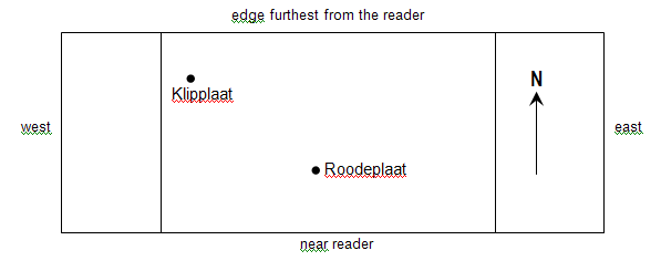
To be useful, a map needs to indicate the direction in which North is located. If such an indication is missing, the map must be rotated to make it readable, i.e. to have words running from left to right. This will position the northern part of the map in the position that is furthest from the reader.
2.1.1 Direction
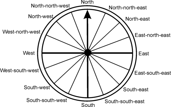
The position of different places on the map in respect of one another can be determined by
The direction of the compass
Always take careful note of the point FROM which and the point TO which you have to work.
Example:
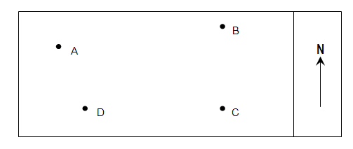
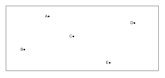
What is the direction FROM A to B = ENE
What is the direction FROM B to C = S
What is the direction FROM C to D = W
What is the direction FROM C to A = NW
What is the direction FROM B to D = SW
What is the direction FROM D to A = NNW
What is the direction FROM A to D = SSE
2.1.2 Bearing
Bearing is a more accurate measurement that direction, because it is expressed as an ANGLE.
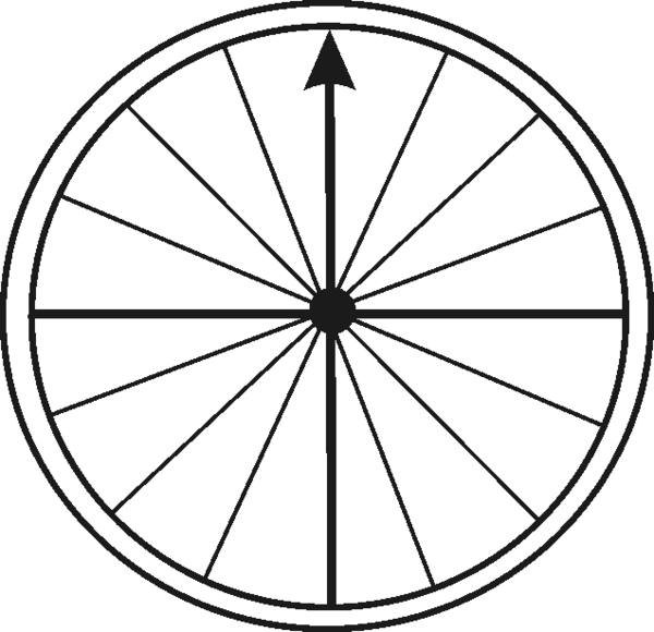
All bearings are taken to the right (clockwise) from NORTH by means of a protractor.
Take good note of the points FROM which and TO which you have to work to determine bearing.
The steps you have to take are:
Connect the relevant points by means of a pencilled line.
Draw the line to North through the point FROM which you have to take the measurement.
Position the protractor by placing 0º against the north line, with the centre on the point from which you have to measure.
Measure the angle from the north line to the connecting line (pencilled line of Step 1) to the right (clockwise).
Example 1:
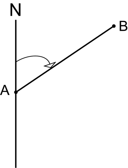 |
| What is the bearing from A to B? |
Example 2:
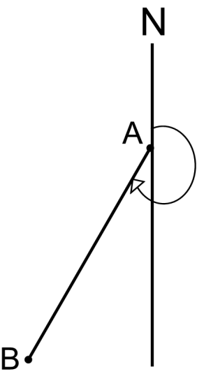
What is the bearing from A to B?
| What is the direction? |
| a) From A to B? |
| b) From C to B? |
| c) From C to D? |
| d) From D to E? |
| e) From E to B? |
| What is the bearing? |
| a) From A to B? |
| b) From C to B? |
| c) From C to D? |
| d) From D to E? |
| e) From E to B? |
| Learning Outcomes(LOs) |
| LO 1 |
| Geographical EnquiryThe learner will be able to use enquiry skills to investigate geographical and environmental concepts and processes. |
| Assessment Standards(ASs) |
| We know this when the learner: |
|
|
|
|
ACTIVITY 1:
ACTIVITY 2:
The Direction
The bearing is
Notification Switch
Would you like to follow the 'Geography grade 8' conversation and receive update notifications?

|
|

|
|

|
|

|
|

|
|

|
|

|
|

|
|

|
|

|