

| << Chapter < Page | Chapter >> Page > |
1. Using lines of longitude and latitude to indicate location
In the same way as we draw lines on a map or plan, imaginary lines are drawn on the earth. Exactly halfway between the north and south poles, we find the EQUATOR. The equator is called the 0° line of latitude, and runs from east to west. Parallel to the 0° line of latitude, we also find a 90°N and a 90°S line of latitude at the two poles.
The equator divides the globe into two halves. The upper half is called the NORTHERN HEMISPHERE and the lower one the SOUTHERN HEMISPHERE.
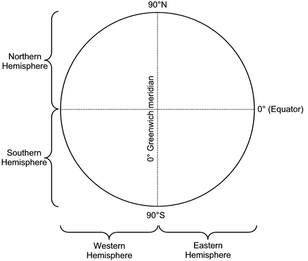
There are also imaginary lines running from north to south. They are called the lines of longitude. The line of longitude lying on 0° is called the GREENWICH line of longitude. It, in turn, divides the earth into a WESTERN HEMISPHERE and an EASTERN HEMISPHERE. East of the Greenwich line of longitude run 180 lines of longitude, and to the west of it there are also 180 lines of longitude.
All these lines of longitude and latitude form intersections on the earth, with which the exact location of a place can be indicated. More about this later. For now it is enough if you are able to indicate in which hemisphere(s) a place, land or continent is.
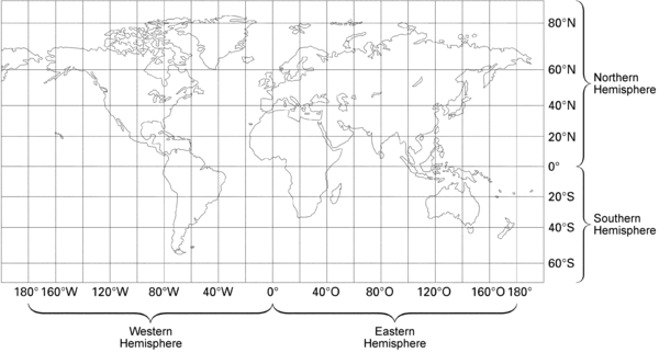
Study a map of the world in your atlas and answer the following questions:
2. Location by means of degrees of longitude and latitude
Lines of longitude and latitude
180
°
160
°W 120°W 80°W 40°W
0°
40°E
80°E
120°E
160°E 180°
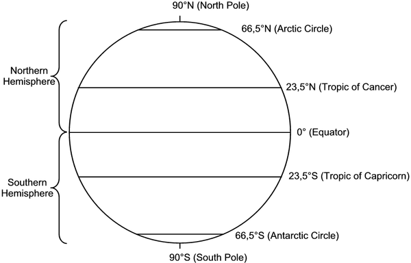
3. Lines of latitude
A few important facts:
The best-known one is the equator (0° line of latitude).
The latitude of a place is a good indication of its climate. You know that places near the equator (0°) are normally very hot. You also know that places near the poles (90°) are very cold. Remember that there are more factors than only latitude that influence climate.
The most important lines of latitude
4. Lines of longitude
A few important facts:
Notification Switch
Would you like to follow the 'Geography grade 6' conversation and receive update notifications?

|
|

|
|

|
|

|
|

|
|

|
|
|
|
|

|
|
|
|
|

|